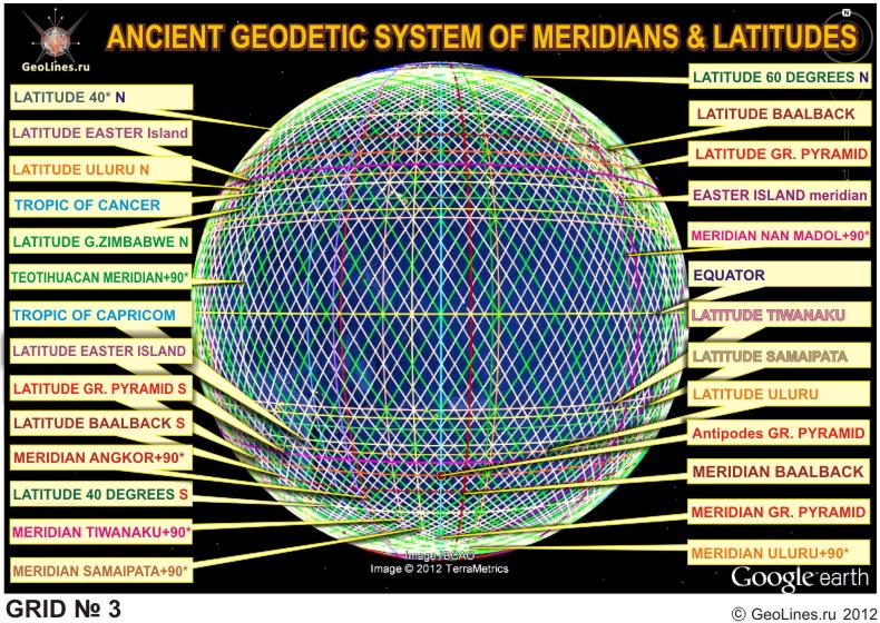
In this part we will view one
more network - №3 which, as well as first two is constructed from a
meridian of the Great
pyramid, but through a bit different latitudes. As it was
already told in the
first part, latitudes of known historical objects are formed
by two subsystems related among themselves. Thanks to that the Network
№3 includes the Tropics,
all System of Ancient Monumental STRUCTURES (SAMS) has fixation to
astronomical parametres of the Earth.
So, the sequence of latitudes
for this network looks as follows: by distance from equator - 0.
Equator, 1. Tiwanaku,
2. Samaypata,
3. Great
Zimbabwe, 4. Tropics, 5. Uluru,
6. Easter
Island,
7. Great pyramid (GP), 8. Baalbek,
9. 40th latitude, 10. 60th latitude.
Read more